Focusing on Canadian Air Power in Normandy
by Alexander Fitzgerald-Black
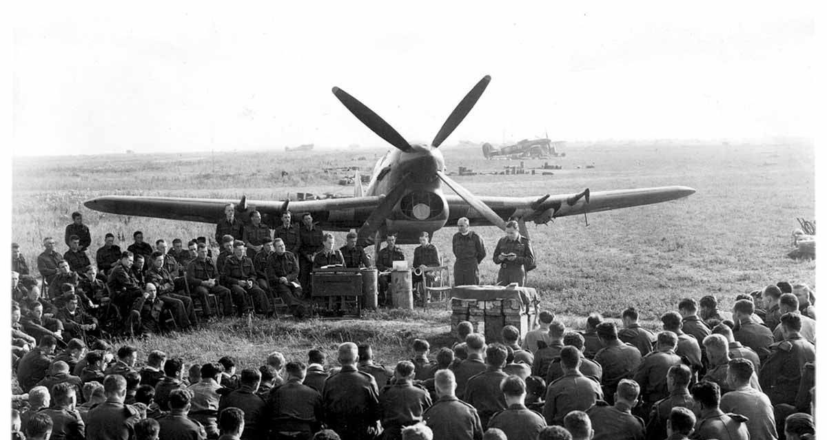
The three Canadian “Bombphoon” squadrons attend mass at B9 Lantheuil France on Sunday 13 August 1944. RCAF 143 Wing Padre Squadron Leader Hebert Ashford MBE presiding (DND Photo).
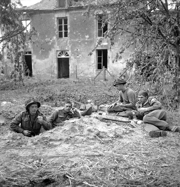
Soldiers of the Highland Light Infantry of Canada having breakfast in Buron, France on 9 July 1944, the day after they took the village (Lieut. Michael M. Dean / Canada. Dept. of National Defence / Library and Archives Canada / PA-131399).
At 2045 hours on 7 July 1944 nine Hawker Typhoon IBs flown by Canadians in 439 “Sabre-Tooth Tiger” Squadron RCAF took off from B5 airfield near Le Fresne-Camilly. It was a short seven kilometres to their target, the village of Buron, which had been a feature of 3rd Canadian Infantry Division’s frontline for a month. Dodging local rain showers and despite a cloud ceiling of just 4,000 feet, the fighter-bombers reached their target without difficulty. Although Typhoons armed with rocket projectiles are famous, the Canadian squadrons were armed with bombs. Their aircraft were affectionately known as ‘Bombphoons’.
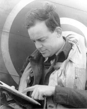
Calls over the radio, “Going down… now”, initiated the dive bomb run. Squadron Leader Hugh Norsworthy led the way. Norsworthy was a pre-war engineering student at McGill University who had completed a stint in the United Kingdom on night fighters and was now midway through his second tour of operations. The Germans managed to put up a small screen of flak, but it failed to deter Norsworthy and his pilots. Their bombs released, the squadron headed back to B5, returning just 15 minutes after they had taken to the air.
The squadron’s operations record book (ORB) recorded the attack as a great success. It reads, “Since the actual target was in close proximity to our forward troops, the terrific damage wrought by dive bombing Typhoons was easily apparent to them all. It is a terrific morale booster to our troops and a shattering blow to the enemy troops.”
Squadron Leader Hugh Norsworthy (439 Squadron Archives)
The Highland Light Infantry of Canada, an infantry battalion positioned to the north of Buron, near Les Buissons, witnessed the attack. They were to capture Buron the next day. So too did the Stormont, Dundas and Glengarry Highlanders near Vieux Cairon to the northwest. Their war diarist recorded, “Air activity increased during the day. At 2100 hours Typhoons rocket-bombed targets around Buron. At 2210 hours Lancasters swept overhead in a great stream to bomb the area Caen-St. Germain-Carpiquet. They met terrific flak but only one plane was seen to be hit and it returned over our lines safely. Estimated 500 planes employed and all agreed it was a grand show.”[1]
I came across this story while researching the Royal Canadian Air Force in Normandy for Project ’44.[2] This amazing new digital commemoration project is an undertaking of the Canadian Research and Mapping Association (CRMA), which specializes in digital preservation, collection management systems, and mapping military history. Project ’44 will see the Canadian Army’s battle in Normandy presented in a way that historians have only dreamt of just in time for the 75th anniversary of the D-Day landings. I was immediately drawn to this project. The website will evolve into one of the most important research tools for historians, history buffs, genealogists, or families trying to uncover the stories of Canada’s past.
In my early conversations with the Project ’44 team, they made it quite clear that this couldn’t just be an army project. The Royal Canadian Air Force fielded 37 squadrons in support of Operation Overlord. Having published Eagles over Husky, a book about the crucial role of the Allied air forces in the invasion of Sicily, I appreciated this approach. Furthermore, I was excited about the opportunities that the mapping tools utilized by the CRMA would present to researchers. What if we could overlay the combat ranges of Canadian aircraft above the battlefield using their bases as an origin point? This would give us a malleable interactive view of the air-land battle, simulating the operations rooms where air marshals and staff officers planned their operations and responded to the situation on the front.
Early map showing RCAF airfields in Normandy. (Airfields collected by Alexander Fitzgerald-Black and mapped by CRMA)
To begin, I had to collect the location data for each of these RCAF squadrons. This required accessing the RCAF operations record books found at Library and Archives Canada (LAC). The good news is that microfilmed copies of these documents are available online at the Héritage project, a collection curated by Canadiana in partnership with LAC and the Canadian Research Knowledge Network. You need to reference LAC finding aids to determine the microfilm reel numbers, and the microfilms are not of the best quality, but it’s still a convenient resource for researchers like me operating on a low budget.
The value-add of CRMA’s Project ’44 is that their website uses up-to-date technology to provide researchers with high-resolution scans of the war diaries, documents, and maps all in one place. They’ve done the job of gathering the data for researchers to mine. It’s the next generation of what Canadiana started over a decade ago!
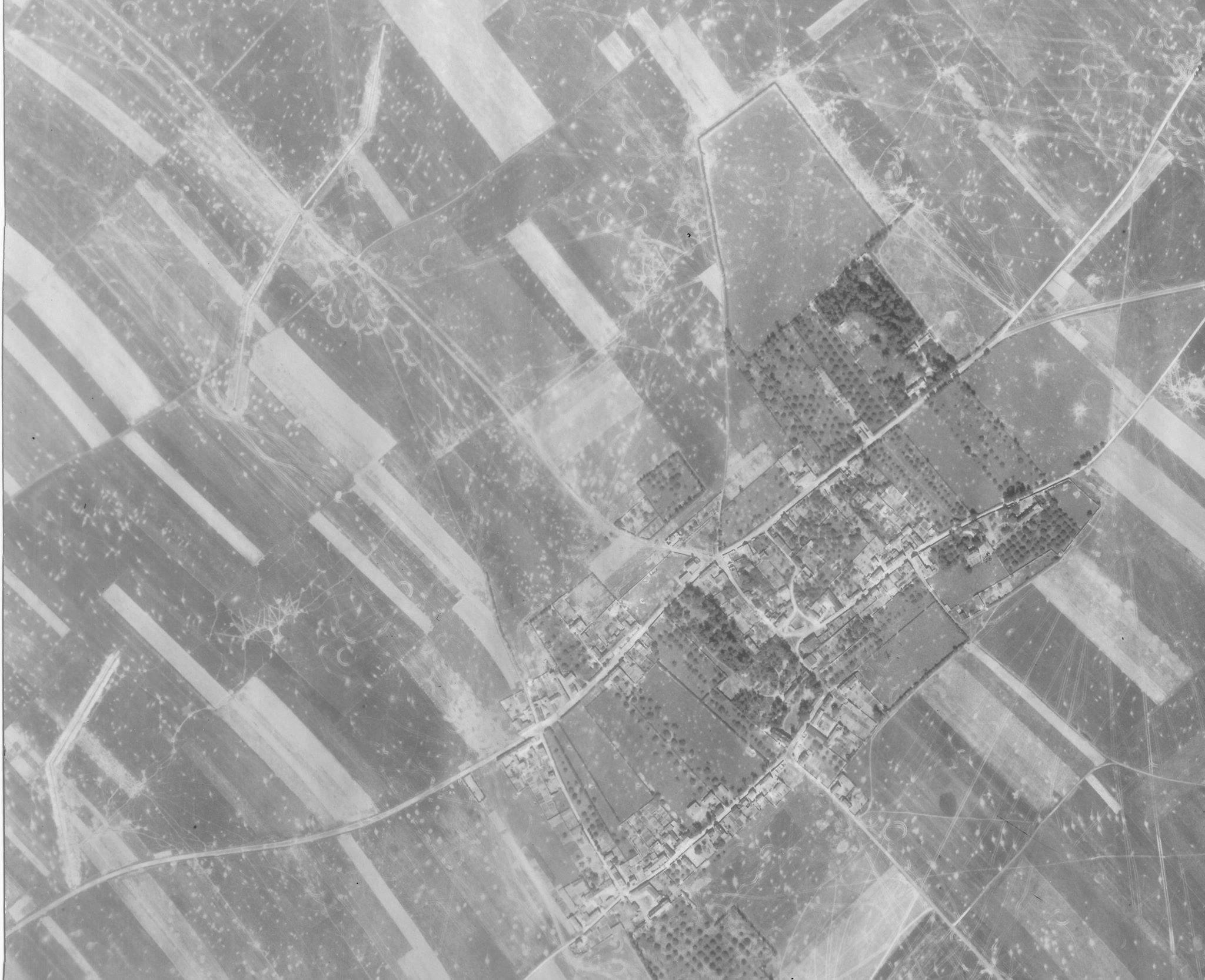
An aerial reconnaissance photo of Buron, taken on 24 June 1944, clearly showing the anti-tank ditches the Germans built for the village’s defence. Tank tracks and cratering indicate the heavy fighting in the area (LCMSDS Air Photo Collection 307/4087).
I went through each operations record book and recorded the name of the squadron’s airfield and noted any changes. The Bomber Command squadrons of 6 Group RCAF hardly moved at all during the Battle of Normandy, but fighter, fighter-reconnaissance, night fighter, and fighter-bomber squadrons moved to Normandy in the weeks following the invasion. To determine the geographic coordinates of each airfield, I referenced a couple of websites. Britain, a staging area for Overlord’s land and naval forces, was an unsinkable aircraft carrier and its countryside is dotted with Second World War airfields. Some of these are still operational Royal Air Force stations. The Airfields of Britain Conversation Trust has an excellent website that I was able to use to determine British airfield coordinates on Google Maps. The Project ’44 team then gave me a crash course in the Military Grid Reference System, and I converted the data for their use.
Airfields in France were another matter. Jean-Pierre Benamou and François Robinard’s La Bataille Aérienne de Normandie 1944 helped me confirm most of the locations after an old website, and a great Wikipedia entry on Advanced Landing Grounds got me started.
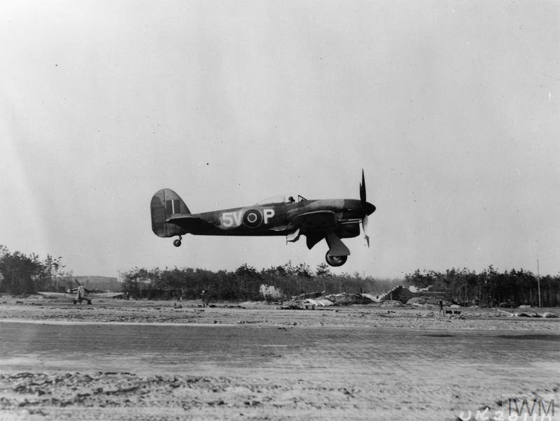
A Hawker Typhoon fighter-bomber of 439 Squadron RCAF returns from a mission over enemy lines. © IWM (MH 6864)
Why is this important? It’s important because the air force’s role on D-Day and in the Battle of Normandy is often unsung. There is plenty to be said about the effectiveness – or lack thereof – of aerial bombardment and close air support for the ground troops, but the air forces performed a variety of other roles.[3] In addition to close air support, air superiority, armed reconnaissance, aerial photography, maritime strike, maritime patrolling, bombing enemy supplies and lines of communication, and air transport missions added up to some 8,178 Commonwealth aircrew killed and missing between 6 June and 31 August 1944. The same figure of killed or missing in shaping operations before the invasion would nearly double this total.[4]
Canadians served in RCAF or RAF squadrons throughout this massive aerial armada. Squadron Leader Norsworthy, who was awarded a Distinguished Flying Cross in September 1944 (in part for his leadership of 439 Squadron), lost seven pilots killed during the Battle of Normandy, over one-quarter of the unit’s authorized strength of 27 pilots. I’m honoured to have played a small but important role in helping Project ‘44 build a comprehensive database that offers new depth and breadth for historians now and into the future. With this resource at our fingertips, the future is bright for telling the stories of Canada’s Second World War veterans.
If you enjoyed this excellent article by Alexander Fitzgerald-Black, consider donating to Project ‘44 so that we can continue to offer great original content and map the Battle of Normandy!
[1] The 500 heavy bombers the SD&G war diary refers to were an impressive sight, but the targets the British Army selected were behind the German strongpoints (for fear of the bombers dropping their loads short onto Anglo-Canadian lines). An adverse weather forecast had also moved up the timetable for the bombing, so the infantry attacked after the German defenders had a chance to recover.
[2] The number of instances when RCAF Typhoons were in direct support of Canadian troops in Normandy are relatively low. The three Typhoon squadrons – 438, 439, and 440 – were mainly tasked in support of the British Army.
[3] See Ian Gooderson’s Air Power at the Battlefront: Allied Close Air Support in Europe, 1943-1945 for a comprehensive examination of this subject.
[4] John Terrain, The Right of the Line: The Role of the RAF in World War Two (Barnsly, UK: Pen & Sword Books Ltd., 2010), 627 and 663.
.

