
How to use the website
Timeline:
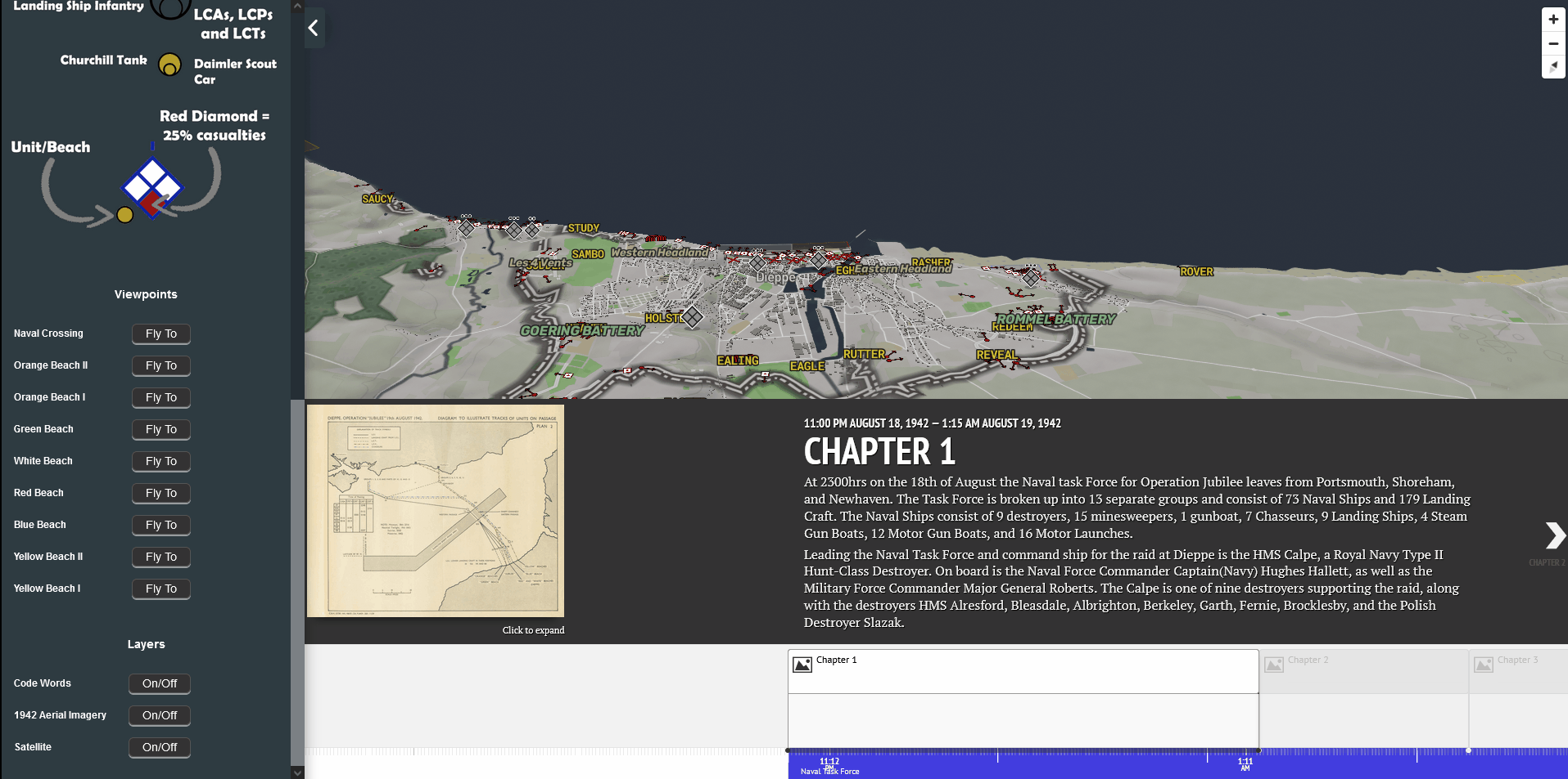
A dynamic timeline powers the web map and forwards the animations. The timeline allows users to understand when events were taking place. Each event is broken down into a chapter, with most chapters covering a 15 minute span of the battle. The bottom of the timeline is colour coded to show the main phases of the operations:
Naval Task Force
Amphibious Assault
Holding the Beach
Withdrawal
Surrender
To advance the timeline and watch the animations press on the arrows on either side of the timeline. Users can also click on individual event chapters, or drag the bottom timeline to a section of the timeline you wish to view.
Located on the left side of the timeline are a series of buttons that allow users to expand or contract the timeline, and a button to reset the timeline to the beginning.

Legend:
The legend is located on the left hand side of the map as a collapsible menu. It contains information on the map symbols for all the unit markers. Each allied unit has a coloured circle that corresponds to the unit and beach it lands at. Gold circles are used to denote the Churchill tanks and Daimler scout cars when landed on the beach.
Out to sea the circles are used to denote groups of ships, individual landing ships and individual assault craft.
How to navigate the map:
Located in the legend are nine viewpoint buttons that can be clicked to move the map around. These viewpoints will quickly move you from various per-determined vantage points to witness the actions taking place.
On the far top right of the web map there are navigation buttons to increase the zoom, and re orientate the map to north.
Alternatively a user can navigate the map using their mouse:
Hold left mouse button to pan
Hold right mouse button to change pitch and bearing
Mouse scroll wheel to zoom.
Ready to check out the Operation Jubilee web map?
Click below